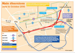
Getting around during the Gdynia Way closure : Phase 1 of the East End Transport Scheme involves the closure of Elliott Road Bridge and Gdynia Way from June – October 2010. See the link below for a leaflet explaining how residents living outside of the East End of Plymouth will get in and out of the city during the closure of Gdynia Way
Leaflet: A Guide Map of Diversions for Gdynia Way June – October 2010
All details relating to this project can also be found on the plymouth.gov website
